None
EN
SPC Severe Thunderstorm Watch 567
['Storm Prediction Center']
SPC Forecast Products
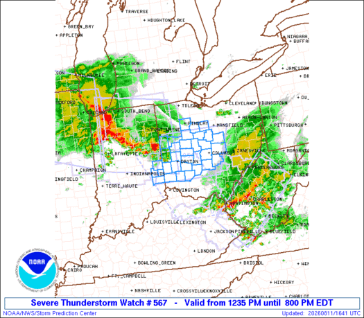
Hazard Tornadoes EF2+ Tornadoes Likelihood Low Very Low Severe Wind 65 kt+ Wind High Moderate Severe Hail 2"+ Hail Low Very Low SEL7 URGENT - IMMEDIATE BROADCAST REQUESTED Severe Thunderstorm Watch Number 567 NWS Storm Prediction Center Norman OK 1235 PM EDT Tue Aug 11 2026 The NWS Storm Prediction Center has issued a * Severe Thunderstorm Watch for portions of Easterm Indiana Western Ohio * Effective this Tuesday afternoon and evening from 1235 PM until 800 PM EDT.
The severe thunderstorm watch area is approximately along and 70 statute miles east and west of a line from 60 miles north northwest of Columbus OH to 45 miles south southeast of Dayton OH.
REMEMBER...A Severe Thunderstorm Watch means conditions are favorable for severe thunderstorms in and close to the watch area.
Severe thunderstorms can and occasionally do produce tornadoes.
&& OTHER WATCH INFORMATION...CONTINUE...WW 563...WW 564...WW 565...WW 566... AVIATION...A few severe thunderstorms with hail surface and aloft to 1.5 inches.