None
EN
Submerged Streets and Stagnant Waters: Why Flooding Persists Along Kano’s Gadon Ƙaya Axis
[]
247 Ureports
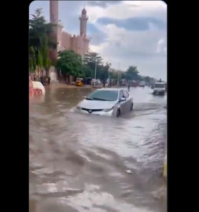
KANO — For residents, business owners, and commuters along the busy Gadon Ƙaya axis in Gwale Local Government Area of Kano State, every heavy downpour brings familiar dread.
Submerged Streets and Stagnant Waters: Why Flooding Persists Along Kano’s Gadon Ƙaya AxisA Basin Effect: Topography and Runoff OverloadA primary driver of the persistent flooding is the natural geographical profile of the Gadon Ƙaya corridor.
Decades of poor municipal waste disposal have turned major gutters along Gadon Ƙaya into informal dumping grounds for polythene bags, single-use plastics, and household refuse.
Additionally, downstream channels connecting Gadon Ƙaya to larger municipal outlets—such as the Jakara/Kofar Mata drainage basin—frequently suffer from water back-ups, forcing floodwaters to remain stagnant in Gadon Ƙaya for hours after storms subside.
Until concrete infrastructural upgrades and strict environmental enforcement are carried out, thousands of residents along the Gadon Ƙaya axis remain at the mercy of every gathering raincloud.