None
EN
U.S. State Dept Apologizes For Map That Mislabels Every African Country
['Ed Scarce']
Latest articles from Crooks and Liars
"Screenshots of the map first appeared in a Substack post by the Aids expert Emily Bass and were widely shared on LinkedIn, with one post garnering about 40,000 views."
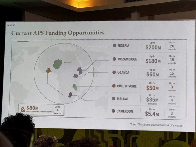
Source: ReutersJuly 30 (Reuters) - A U.S. government map of Africa mislabeled every country during a State Department presentation at a global conference taking place in Brazil this week, causing a stir among attendees who took screenshots and posted them online.
A Reuters analysis found the image of the map included in the presentation contained an artificial intelligence watermark that signals it was made with OpenAI tools.
The State Department said it took "full responsibility" for the confusion caused and that the map had been produced by a team member who hastily changed the slide deck before the event.
The map showed Nigeria, where the U.S. currently has several hundred troops deployed, as landlocked in the Sahara Desert.