News Tech
EN
France’s Wildfires Just Triggered Something the Country Has Never Seen Before
['Passant Rabie', 'Matthew Wille', 'Ellyn Lapointe']
Gizmodo
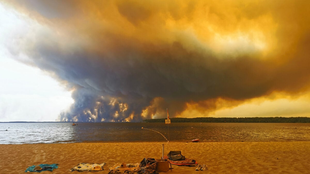
With massive wildfires, large amounts of energy and heat drift upwards, creating a smoke plume.
When there’s enough moisture in the atmosphere, the smoke plume condenses to form a cloud.
When pyrocumulonimbus clouds form above fires, they can create winds that cause the blaze below to spread even faster and develop a more unpredictable pattern.
Earlier this week, French authorities reported their first pyrocumulonimbus cloud, which appeared near Bordeaux.
The European Centre for Medium-Range Weather Forecasts has not yet confirmed whether this was in fact France’s first pyrocumulonimbus, CNN reported.