None
EN
NASA-ISRO Radar Mission Maps Mississippi Delta With Cloud-Piercing Precision
['Dc Correspondent', 'About The Author']
Deccan Chronicle - News Headlines | Today Headlines | Hyderabad News | English News | Top Stories | Breaking news
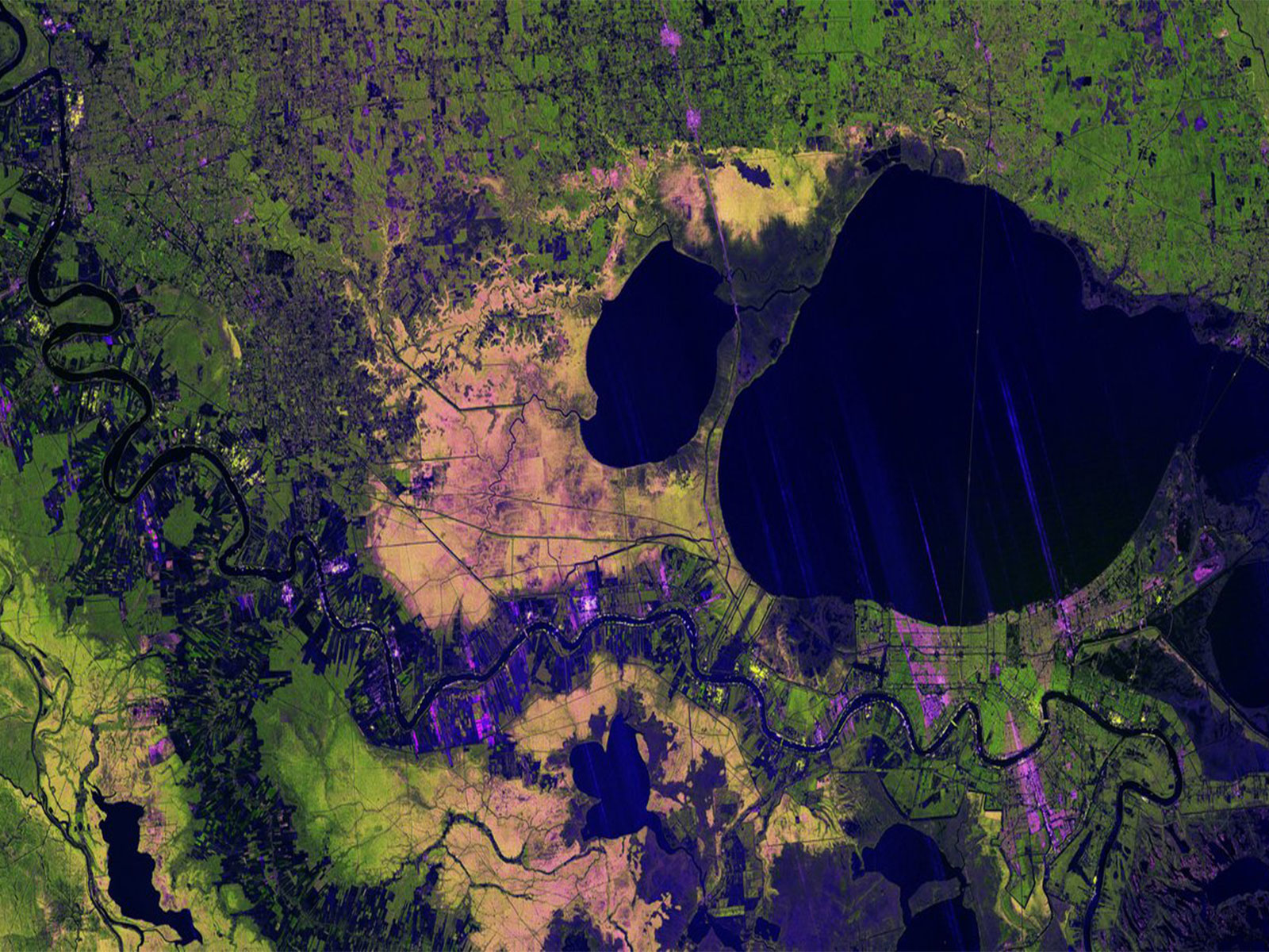
The colourful image, created using data gathered by the NASA-ISRO Synthetic Aperture Radar (NISAR) satellite in late autumn, focuses on the Mississippi River Delta region in southeastern Louisiana.
Unlike optical imagery taken the same day, which was largely obscured by clouds, the radar-based image clearly maps the terrain below.
Developed by NASA's Jet Propulsion Laboratory in Southern California, the L-band radar uses microwaves with a wavelength of about 24 centimetres, allowing signals to pass through clouds and image the ground beneath.
Managed by Caltech, JPL leads the US contribution and supplies the L-band SAR and antenna reflector, while ISRO provides the spacecraft bus and S-band SAR.
It gathers data using a large drum-shaped reflector measuring 12 metres wide -- the largest radar antenna reflector NASA has ever sent into space.