None
EN
NASA-ISRO Radar Mission Peers Through Clouds to See Mississippi River Delta
['Jet Propulsion Laboratory']
NASA
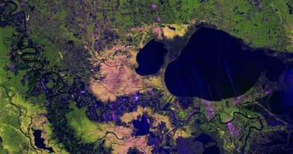
NASA/JPL-Caltech This same Nov. 29, 2025, image from NISAR’s L-band SAR instrument features labels noting cities and geographic features of the Mississippi River Delta region.
A U.S.-Indian Earth satellite’s ability to see through clouds, revealing insights and characteristics of our planet’s surface, is on display in a colorful, newly released image showing the Mississippi River Delta region in southeastern Louisiana.
The bright green areas to the west of the Mississippi River, which snakes from Baton Rouge in the upper left to New Orleans in the lower right, are healthy forests.
The Fairbanks-based facility stores and distributes NASA’s SAR data.
Managed by Caltech, JPL leads the U.S. component of the project and provided the satellite’s L-band SAR and antenna reflector.