None
EN
Weather Forecast: A few rain/snow showers to end the week then warmth arrives
['Erin Yost']
Homepage
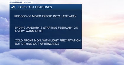
MISSOULA — Lightly scattered mixed precipitation (including pockets of freezing rain) will continue into early Saturday with highs in the mid 30s to mid 40s as a few weak disturbances move through.
Northwest Montana will see the best chance for moisture, but check road reports before traveling during the mornings for slick spots.
Starting Saturday, strong high pressure will build over the western U.S., allowing for a drying and warming trend.
I’d expect a mix of clouds and sun with highs Saturday & Sunday in the upper 40s to almost upper 50s (pushing records for some)!
High pressure looks to rebuild directly after Monday’s front keeping a warm and dry trend in place (potentially through Feb. 8).