None
NL
What parts of Massachusetts have the best chance of being slammed by nor’easter bomb cyclone?
['Rick Sobey']
Boston Herald
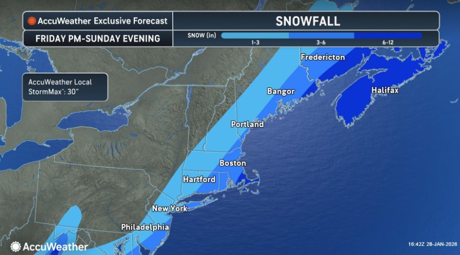
Meteorologists continue to closely track a potent nor’easter for Sunday, and it appears that the best chance for significant snow will be across Cape Cod, Nantucket, and Martha’s Vineyard.
Forecasters caution that there’s still a large amount of uncertainty in the track of the storm, resulting in a wide range of possible impacts.
The nor’easter will likely rapidly strengthen into a bomb cyclone.
The National Weather Service’s Boston office says it’s “maintaining a close watch” on the potential coastal storm late this weekend.
“Tracks range from a hit to a full miss with some in between solutions showing a ‘graze’ hit to the Cape/Islands in regards to impacts,” NWS Boston added.